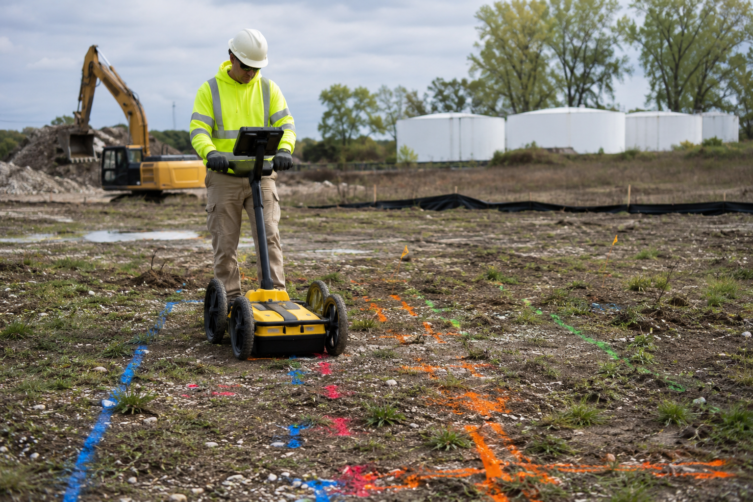
Environmental sites can hide a lot below the surface. Searching for experienced utility locators near me helps crews look past old maps, faded records, and best guesses before work begins. One buried tank, pipe, drum, or slab conflict can change the job fast once drilling starts.
Geotek Services helps environmental teams get a clearer view of what may be underground before crews move in. Our locating work supports safer planning for surveys, borings, audits, scanning, and site checks. Better information upfront can help prevent delays, damage, and expensive surprises.
Safe work starts before the drill touches the ground.
Read on to see the problems utility locating can help prevent on environmental sites.
Key Takeaways
- Hidden site features can turn fieldwork into a bigger problem fast.
- Good locating helps crews make better calls before work begins.
- Old records miss things, so subsurface checks matter.
Hidden Utility Strikes
A utility strike can turn a planned site check into a safety problem, a schedule delay, and a budget fight. Utility locating helps environmental teams select more efficient work areas before drilling, trenching, or sampling begins.
Keep Borings Away From High-Risk Areas
Boring locations can look simple on a site map until buried services crowd the work zone. A small shift in the boring plan can help crews avoid damage while still gathering the data the project needs. Locating provides the field team with more context before they place equipment in a risky spot.
Reduce Confusion During Field Work
Crews lose time when they uncover a line no one expected. The team may need to pause, call for review, move equipment, and wait for direction before work continues. Locating before field work helps reduce those stop-and-start moments that slow the whole site down.
Protect The Sampling Plan
A utility conflict can force crews away from the original sampling area. That move can affect boring spacing, lab data, access routes, and how the site story is built. Early locating helps environmental teams keep the plan useful without risking a strike.

Bad Borehole Placement
A boring spot can look safe on the surface and still hide trouble underneath. Pipes, conduits, tanks, old slabs, or buried debris can sit right where the drill is planned. Utility locating helps crews shift boring points before a hidden conflict turns a simple site check into a bigger problem.
Poor borehole placement can also undermine the sample’s value. A boring placed too close to buried debris or an unknown feature might give the team information that does not match the real site concern. Better locating helps environmental crews protect the survey goal while keeping fieldwork safer and more controlled.
Missed Underground Storage Tanks
Old tanks have a way of staying hidden after the paperwork is gone. Former service stations, farms, industrial sites, and commercial lots can all conceal buried history beneath seemingly ordinary ground. One missed tank can force new testing, extra safety steps, and a major change in the survey plan.
Ground-penetrating radar helps environmental teams identify potential tank-shaped targets before fieldwork moves too far. A tank can sit near a planned boring, below an old fueling area, or beside a structure that no longer exists. Finding that concern early gives the team time to adjust the work area before the site starts creating bigger problems.
A missed underground storage tank can turn a simple survey into a more time-consuming and expensive job. Crews may need to pause work, bring in more support, or rethink the next round of site checks. Better scanning upfront helps reduce surprises and gives the environmental team a stronger read on what the property may be hiding.
Buried Drums Nobody Expected
A paved lot can hide a rough past under a clean surface. Buried drums may point to old waste-handling practices, spill areas, or disposal choices that no one wrote down. Utility locating and GPR scanning help flag suspicious shapes before crews drill, dig, or sample in the wrong spot.
Ground that has been graded or reused for years can still hold serious surprises. A drum hit during fieldwork can slow the job, raise safety concerns, and force the team to change the plan fast. Early scanning gives environmental crews a better chance to spot warning signs before hidden materials are disturbed.
Damaged Monitoring Wells
A monitoring well does not always stay easy to see after years of site changes. Pavement gets added, caps break, soil shifts, and old records stop matching what crews find in the field. Once that well is hidden, a drill rig, saw cut, or truck path can damage it before anyone knows it is there.
That kind of damage creates more than a repair issue. The team can lose access to past groundwater data, delay the next phase of work, and spend time sorting out a problem that could have been avoided. Utility locating gives environmental crews a better chance to work around old or hidden wells before a small miss turns into a costly field setback.

Contamination Spread During Drilling
A drill hole can create a new problem when the ground has hidden risks below the work area. Poor placement can connect soil layers, disturb buried waste, or strike a feature that changes site conditions without warning. Utility locating helps crews work around buried hazards before a sampling plan turns into a larger environmental concern.
The wrong drilling spot can create problems the team did not plan for:
- Crossing Into A Problem Layer: Drilling through the wrong zone can give contamination a path into cleaner soil or groundwater. Better site checks help crews avoid buried features that could connect areas meant to stay separate.
- Striking A Pressurized Line: A hidden line under pressure can release water, waste, or gas once damaged. That release can change the work area fast and force crews to stop before the survey goal is reached.
- Disturbing Buried Waste: Old drums, tanks, or disposal areas can turn routine drilling into a safety and cleanup issue. Locating helps flag suspicious areas before crews set equipment over the wrong spot.
- Skewing The Sample Data: A boring placed too close to a buried feature can change what the sample appears to show. Field checks help crews choose better locations so the data better support the survey’s real purpose.
Safer drilling starts with knowing what the ground may be hiding before the bit goes in.
False Confidence From Old Site Plans
A clean site plan can fool the whole crew. The page may look simple, but the ground may hold old lines, moved pipes, or buried items no one marked. That false confidence can push fieldwork into trouble before the team sees the risk.
Records age fast on busy environmental sites. Repairs happen, utilities shift, and old service paths get left behind. Utility locating helps the crew check the ground instead of trusting a plan that may be wrong.
Bad information can turn a small site check into a long delay. Drilling in the wrong spot can damage a line, miss the real concern, or force the team to start over. Better field data helps crews make safer calls before equipment touches the ground.
Searching For Experienced Utility Locators Near Me?
Environmental work gets harder when the ground holds more questions than answers. Geotek Services helps crews spot hidden utilities, tanks, drums, slab issues, and old site features before they create delays or damage. A better look below the surface can help your team move forward with less guesswork and fewer costly surprises.
Frequently Asked Questions
How does utility locating help with environmental surveys?
Utility locating helps crews understand what may be buried before drilling, sampling, or scanning begins. It can point out hidden lines, tanks, drums, drains, and slab issues that may change the work plan.
Why are old site maps not enough for environmental work?
Old site maps can leave out private utilities, abandoned lines, and past site features. A subsurface check gives crews fresher information before they trust a plan that may no longer match the ground.
Can utility locating help prevent project delays?
Yes, utility locating can help prevent delays by finding possible conflicts before field crews arrive. When crews know more upfront, they can adjust boring spots, scanning areas, and equipment plans with less stress.
What hidden site features can affect environmental testing?
Buried tanks, drums, old pipes, sewer lines, drains, debris, and concrete slab conflicts can all affect testing. These features can change where crews drill, how they sample, and what safety steps they need to take.
Why should crews scan concrete slabs on environmental sites?
Concrete slabs can hide rebar, conduits, pipes, drains, and other embedded features. Scanning before cutting or coring helps crews avoid damage and make better choices before work starts.