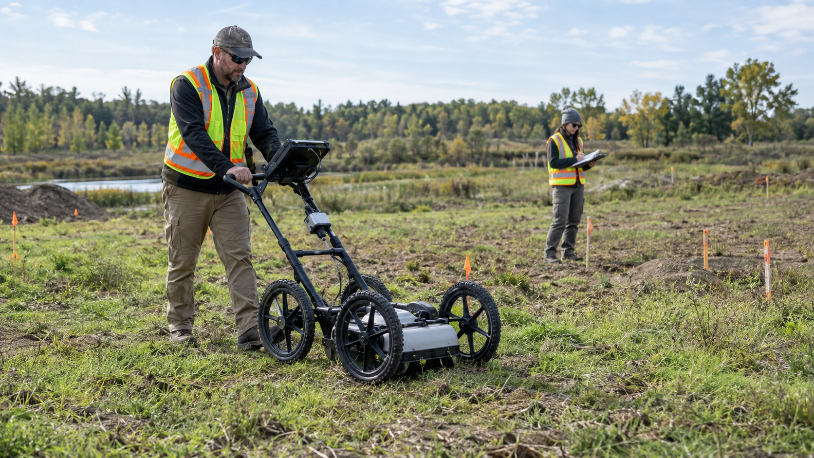
Environmental survey work often starts with questions about what may be hidden below the surface. GPR services can help teams look beneath the ground before they decide where to focus their next steps. Better site information can make planning easier and help reduce guesswork during the investigation.
Different buried features can leave different signals, which makes each site a little different. Geotek Services helps teams gather useful subsurface information before environmental work moves forward. A broader view of the area can help crews understand where more attention may be needed.
Knowing what GPR can help investigate gives teams a better sense of what the technology brings to an environmental survey.
Read on to see the types of environmental survey targets GPR can help investigate below the surface.
Key Takeaways
- GPR can help environmental teams spot buried features that may shape where the investigation goes next.
- Old tanks, utilities, debris, and other subsurface targets can leave clues worth a closer look.
- A wider view below the surface can help teams narrow the search and plan smarter follow-up work.
Buried Tanks Can Reshape the Investigation
A buried tank can change the whole direction of an environmental survey once it comes into view. GPR can help teams narrow down where that feature may be sitting so the next round of work has a clearer starting point.
Tank Size Can Change the Scope of Follow-Up Work
A large buried feature may affect a wider area than crews first expected. Its size can help teams judge how much ground may need closer study around the suspected tank. That can shape where later testing or excavation is focused.
Nearby Piping Can Reveal More of the Story
Old tanks may have fill lines, vent pipes, or other connections leading away from the main structure. These extra features can help crews understand how the system was once laid out below the property. Finding them can also point to other areas that deserve a closer look.
Surface History Can Help Confirm the Location
Old pads, patched pavement, or changes in the ground surface can add useful context to GPR findings. When those clues line up with a buried target, teams may have more reason to focus on that area. Matching surface evidence with subsurface data can make the next step more targeted.
Old Tank Areas Can Leave More Than a Tank
A former tank site can hold more clues than the tank itself. Old pipes, fill lines, or disturbed soil may still remain after the main tank is gone. Those extra signs can help show how the system once worked across the property.
GPR can help crews look beyond a single large target and study the surrounding area. Changes in the ground may point to old connections, trenches, or other parts tied to past use. That broader view can help the environmental team decide where a closer check may make sense.
Buried Drums Can Stand Out in Unexpected Places
Buried drums can turn up far outside the spots shown on old site records. Paving, grading, and later construction can hide where disposal areas once sat. That is why unusual responses in open or overlooked parts of a property can matter.
GPR services can help crews scan those areas for shapes and patterns that do not match the surrounding ground. Several similar targets close together may suggest a buried group rather than one random object. That gives investigators a tighter area to study, rather than treating the whole property the same way.
Geotek Services can use the scan results to help guide where the next round of checking should happen. Radar cannot confirm what every buried object is, but it can show where something different may be present. That kind of direction can make follow-up work more focused and less dependent on old records alone.
Debris Fields Can Reveal Past Site Activity
Construction debris buried beneath the ground often creates a messy pattern rather than a single clear object. Mixed materials can cause radar responses to change across the same part of a site. Those shifts can help show where older fill or dumping may have taken place.
Environmental teams can use that pattern to compare disturbed ground with nearby areas that look more natural. The edge of a debris field may reveal where past activity started and how far it spread. Seeing that difference can give investigators a better sense of how the property may have been used years ago.
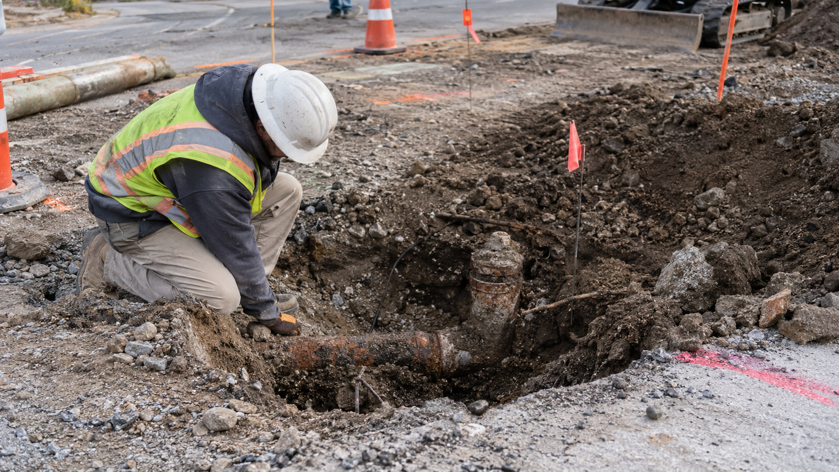
Abandoned Utilities Can Cross Planned Borings
Old utility lines can still create problems long after they stop carrying service. A buried route may sit right where a team plans to place a boring, well, or testing point. GPR can help reveal those crossings before drilling starts.
The right subsurface check can help crews make better choices before equipment moves in:
- Boring Locations Can Be Shifted Early: A planned hole can often be moved when an old line appears in its path. That small change may help crews avoid damaging buried material or losing time once drilling starts.
- Unexpected Crossings Become Easier to Plan Around: Abandoned lines may run at odd angles or follow routes that no longer match current site use. Seeing those paths ahead of time helps the team work around them rather than find them by accident.
- Old Utility Corridors Can Explain Other Anomalies: A buried line may sit beside trenches, backfill, or older infrastructure that also affects the scan. That added context can help investigators understand why one part of the site looks different below ground.
- Drilling Crews Get Better Site Information: Marking likely crossings gives the field team something useful to review before setting up equipment. Better awareness can help keep the investigation focused and reduce avoidable surprises.
Finding abandoned utilities before drilling gives the team a clearer path into the next phase of the work.
Plastic Lines Need a Different Kind of Clue
Plastic utilities do not give crews the same easy signal that metal lines can provide. GPR looks for changes around the pipe, including soil, backfill, and what may be inside the line. Those differences can help reveal a route that might otherwise be hard to spot.
Installation details matter because the pipe itself may not stand out very well below ground. A trench with different fill can create a useful clue even when the PVC is difficult to see. Reading the pipe and the ground around it together can give the crew a better picture of where the line may run.
Electrical Corridors Can Hold Several Targets
Electrical areas can get crowded fast below the surface. Conduits, pull boxes, and nearby utility lines may all run through the same strip of ground. GPR can help show those separate features rather than making the corridor look like a single path.
A busy layout matters when an environmental team needs room for a boring or monitoring point. Crews may have to work around several buried targets before they find a safer spot. Seeing more of the corridor can help them make that choice with better information.
That wider view can also help explain why one section of ground looks more complex than another. Several buried features can create a pattern that is easy to misread without enough context. Mapping the area first can make later field work more controlled and less uncertain.
See More of the Site Before Moving Forward With GPR Services
Hidden features can shape an environmental survey long before crews break ground. Geotek Services helps teams see where buried targets and unusual subsurface areas may deserve a closer look. Better information below the surface can make the next stage of the investigation easier to plan.
Frequently Asked Questions
What can GPR reveal during an environmental site survey?
GPR can show buried features and unusual subsurface changes that may deserve more attention. These findings can help teams narrow the area for follow-up work.
Can GPR help locate buried storage tanks?
GPR can help identify the position and general footprint of a buried storage tank when site conditions allow. The scan may also show nearby features tied to the old tank system.
Can GPR help find buried drums or debris?
GPR can help reveal subsurface anomalies linked to buried drums, debris, or disturbed areas. A group of similar responses can give the survey team a more focused place to investigate.
Can GPR locate old monitoring wells?
GPR can help search for monitoring wells that became harder to find after paving, grading, or other site changes. Finding an older well can reconnect the current survey with past environmental work.
Why are subsurface anomalies important during an environmental survey?
Subsurface anomalies show where the ground looks different from the surrounding area. These changes can help investigators decide where closer testing or review may be useful.